How We Deliver 3D City Intelligence
City Digital Twin Data Fusion
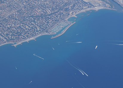
Multi-source geospatial datasets—LiDAR, satellite stereo imagery, aerial photogrammetry, BIM, GIS, and cadastral records—are integrated into a single coherent 3D data environment. This fusion is structured using open standards such as CityGML and IFC, ensuring that buildings, terrain, networks, and assets are represented with both geometric accuracy and rich semantics suitable for urban digital twins and smart city applications.
Intelligent 3D Models
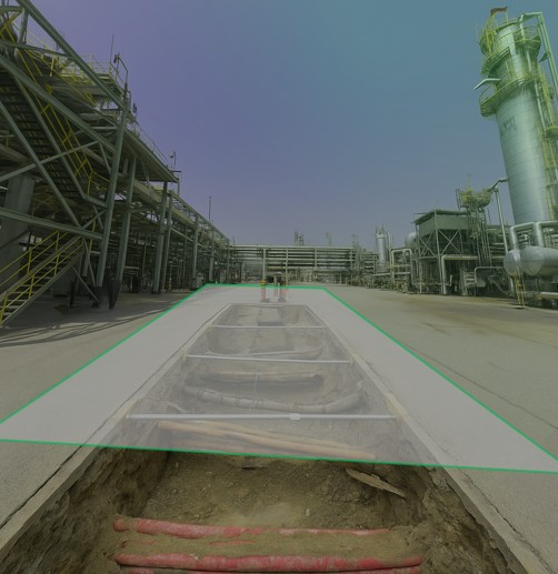
Advanced 3D city modeling workflows transform raw point clouds and imagery into multi-LOD city models, BIM-ready infrastructure assets, and photorealistic textured meshes aligned to real-world coordinate systems. These models are engineered to support end-to-end lifecycle use cases—from master planning and detailed design to construction coordination and asset operations—within a consistent, geospatially accurate 3D context.
Operational Digital Twins for Simulation
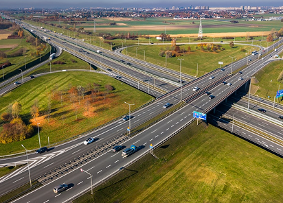
CityGML-compliant urban models and BIM-integrated infrastructure twins are delivered in formats optimized for solar, wind, noise, flood, traffic, and RF propagation engines. By providing clean, standardized, and topology-aware 3D geometry, these datasets remove the usual preprocessing bottlenecks and allow engineers and analysts to run high-fidelity “what-if” simulations long before physical works commence.
Enterprise Access to 3D Intelligence
Browser-based 3D viewers and dashboards publish city-scale digital twins to both technical and non-technical stakeholders via standard web browsers. Users can explore assets, interrogate attributes, visualize live sensor feeds, and interact with scenarios in real time, turning 3D models into continuously updated operational intelligence for smart city governance, resilience planning, and asset lifecycle management.