Introduction
Every vessel dimension survey faces the same quiet bottleneck: common points. Whether you are laser-scanning a ship hull, a subsea structure, or a large industrial pressure vessel, you almost never capture the whole object from a single position. You take multiple scans, then stitch them together — and that stitching traditionally depends on common points (also called control points or tie points) that are visible from more than one scan position.
The more common points you need, the more targets you place, the more setups you survey, and the longer your team spends in the field — often in congested, elevated, or hazardous environments. So a practical question has become increasingly important: can we run an accurate vessel dimension survey with a minimum number of common points?
Increasingly, the answer is yes — and machine learning is a large part of why. This article explains what common points do, why minimizing them matters, and how machine learning is changing point cloud registration for vessel surveys.
What is a vessel dimension survey?
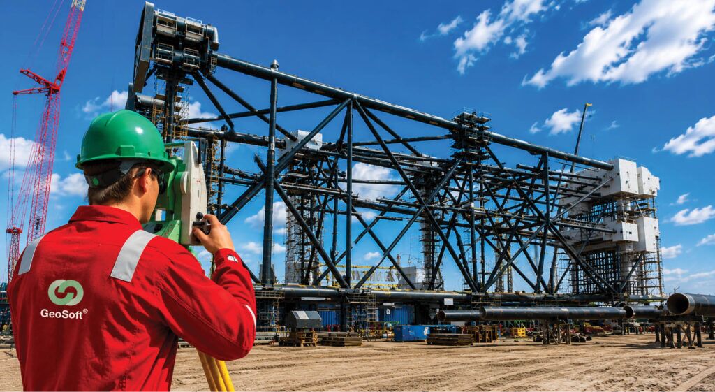
A vessel dimension survey is the precise measurement of a vessel’s geometry — its overall dimensions, shape, key features, and tolerances — usually captured with 3D laser scanning, total stations, or photogrammetry. The term “vessel” covers two common cases:
• Marine vessels — ship hulls, decks, and structures, for shipbuilding, refit, dimensional control, and deformation checks.
• Industrial / process vessels — tanks, pressure vessels, and columns, for as-built documentation, fit-up, and Scan-to-BIM.
In both cases, the deliverable is the same in spirit: a trusted, dimensionally accurate 3D model an engineering team can make decisions from.
The role of common points in survey registration
Because a vessel is rarely captured in one scan, multiple scans must be brought into a single coordinate system — a process called registration. To align two scans rigidly (rotation and translation, with no distortion), you mathematically need at least three non-collinear common points shared between them. In practice, surveyors place more than the minimum to improve reliability and reduce error propagation across a chain of setups.
These common points come in a few forms: artificial targets (spheres, checkerboards) placed in the scene, identifiable natural features, or surveyed control points tied to a project datum. Each one takes time to place, scan, and check — and on a complex vessel, access and line-of-sight constraints make good target geometry genuinely hard to achieve.
Why minimize the number of common points?
Reducing the common points a survey relies on delivers real, measurable benefits:
• Less field time and cost. Fewer targets to place and fewer setups to constrain means faster acquisition — a direct saving on day rates, especially offshore.
• Safer surveys. Many vessel surfaces are elevated, confined, or hazardous. Fewer manual targets means less time spent in those zones.
• Better access in congested geometry. On a piping-dense plant vessel or a complex hull, there often isn’t room to place ideal targets — minimizing reliance on them removes that constraint.
• Reduced human error. Manual target placement and identification are error sources; reducing them can improve consistency.
The catch, historically, is that fewer common points usually meant weaker registration and lower confidence in the final dimensions. That trade-off is what machine learning is now helping to break.
How machine learning reduces the need for common points
Machine learning improves registration by making the matching step smarter, so the survey depends less on manually placed common points. The most relevant approaches include:
1. Learned feature detection and matching.
Instead of relying on artificial targets, deep-learning models can detect and describe distinctive geometric features directly in the point cloud, then match them between scans. Learned 3D feature descriptors are more robust to noise, partial overlap, and viewpoint change than older hand-crafted methods — meaning reliable correspondences can be found from the vessel’s own geometry rather than from added targets.
2. Deep / coarse-to-fine registration.
Machine-learning models can produce a strong coarse alignment of two scans, which is then refined by classical algorithms such as Iterative Closest Point (ICP). This hybrid pipeline tends to converge accurately even when overlap is limited and common points are sparse — exactly the conditions a minimal-target survey creates.
3. Robust outlier rejection.
A major reason registration fails with few points is bad correspondences. Learned alternatives to RANSAC-style filtering can separate true matches from false ones more reliably, so the few correspondences that exist are trustworthy enough to solve the alignment.
4. Automated target and feature recognition.
Where targets are used, ML can detect and label them automatically, removing manual identification effort and error — letting a smaller, well-chosen set of common points do more work.
The net effect: machine learning lets a vessel dimension survey extract reliable correspondences from the object’s own shape and a minimal set of points, rather than depending on a dense network of manually placed targets.
Accuracy and validation: the part you can’t skip
Reducing common points should never mean reducing confidence. Any minimal-point, ML-assisted workflow must be backed by rigorous quality control:
• Registration error reporting — cloud-to-cloud and target residuals quantified, not assumed.
• Independent check measurements — a small number of verified control points used to validate (not drive) the result.
• Overlap and coverage checks — ensuring scans share enough geometry for the model to work with.
• Deliverable tolerance against project spec — confirming the final model meets the dimensional tolerance the engineering decision actually requires.
Machine learning is a tool to achieve accuracy more efficiently — the accountability for the final accuracy still rests on disciplined survey methodology.
Where this matters in practice
Minimal-common-point, ML-assisted vessel surveys are especially valuable in:
• Shipbuilding and marine refit — fast, accurate hull and structure capture with fewer targets on complex curved surfaces.
• Offshore and subsea structures — where access, time, and safety constraints make every reduced setup count.
• Industrial and pressure vessels — congested plant environments where ideal target placement is impractical, supporting Scan-to-BIM and brownfield modification.
• Dimensional control and fit-up — ensuring fabricated sections match design before installation, with efficient as-built capture.
Limitations and best practice
• Sufficient overlap and features required. ML-assisted registration needs distinctive geometry — featureless or highly symmetric surfaces remain challenging and may still need targets.
• Minimum points cannot go to zero on critical work. A small number of validated control points is still best practice to anchor and verify the result against a project datum.
• Results depend on data quality and expertise. The technology augments a skilled survey workflow; it doesn’t replace it.
The goal is not “no common points,” but the minimum number of common points needed to achieve and prove the required accuracy.
Conclusion
The common-point bottleneck has long been one of the hidden costs of vessel dimension surveys — driving field time, cost, and risk. Machine learning is steadily loosening that constraint by finding reliable correspondences in a vessel’s own geometry, enabling accurate registration with fewer manually placed points. The result is faster, safer surveys that still meet the dimensional standards engineering decisions demand.
At Geosoft Global, precision is the point — above ground, below it, and beneath the sea. We combine high-density 3D laser scanning, reality capture, and rigorous dimensional control with modern data workflows to deliver vessel survey data engineering teams can trust.
Intelligence. Precision. Depth.
Planning a vessel dimension survey? Talk to our survey team about an efficient, accuracy-assured approach.
Frequently Asked Questions
What is a dimensional control survey?
A dimensional control survey is the precise measurement of fabricated components and structures to verify they match design tolerances before installation. Using 3D laser scanning and metrology, it confirms that parts will fit correctly on the first attempt — critical in fabrication, offshore, and pressure-vessel work.
What is a common point in a survey?
A common point (or tie/control point) is a feature or target visible in two or more scan positions, used to align separate scans into a single coordinate system during point cloud registration.
What is the minimum number of common points needed to register two scans?
Mathematically, at least three non-collinear common points are needed for a rigid transformation. In practice, more are used for reliability — though machine-learning methods can reduce dependence on manually placed targets.
Can machine learning fully replace control points in a vessel survey?
Not entirely for critical work. ML can dramatically reduce reliance on common points by matching natural geometry, but a small set of validated control points is still best practice to anchor and verify accuracy against the project datum.
How accurate is an ML-assisted vessel dimension survey?
Accuracy depends on data quality, surface geometry, overlap, and validation. A properly executed, ML-assisted workflow can meet the same tolerances as a traditional survey while using fewer common points — provided registration errors are measured and independently checked.
How does dimensional control reduce offshore costs?
Dimensional control reduces offshore costs by ensuring fabricated spools, modules, and structures fit first time. Catching a few-millimetre deviation in the yard avoids re-fabrication, schedule delays, and expensive offshore vessel time — making dimensional control one of the highest-ROI surveys in energy projects.
What technology is used for dimensional control surveys?
Dimensional control surveys use 3D laser scanning, total stations, and photogrammetry to capture high-accuracy as-built measurements. Point cloud data is then compared against design models to verify tolerances, flange alignment, and fit-up before installation.
Which industries use vessel dimension surveys?
Vessel dimension surveys are used in shipbuilding and marine refit, offshore and subsea engineering, and for industrial and pressure vessels — supporting dimensional control, fit-up verification, as-built documentation, and Scan-to-BIM.