Success Stories
In-depth insights from our successful projects and the measurable impact we've delivered for our clients
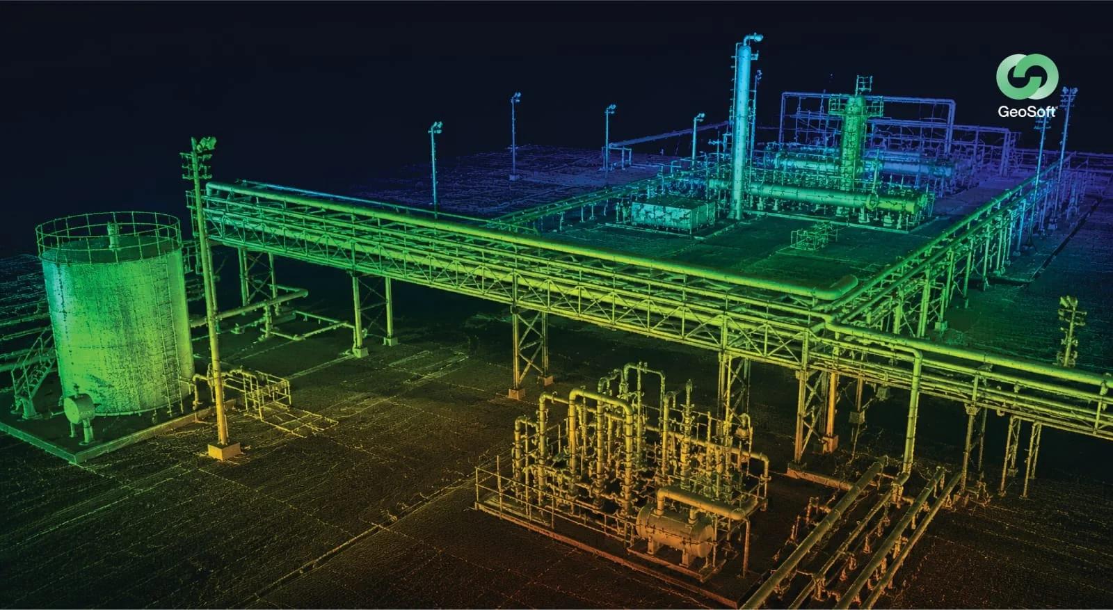
Refinery As-Built Scanning to Digital Twin & AR/VR
From a single high-fidelity laser scan of a live refinery to a fully contextual digital twin, deployed in immersive AR/VR for training, simulation and remote operations, one capture, a decade of use.
1. Challenge
An EPC brownfield modification project required capturing the as-built state of an operating refinery's Residue Hydrocracking Unit and surrounding plant area. The scope demanded that dense, congested plant areas be captured with sufficient accuracy to support engineering design without further site visits, all while observing strict live-refinery HSE controls and minimising disturbance to ongoing operations. Beyond the immediate engineering need, the operator wanted the as-built data to deliver lasting value: a reusable digital asset that engineering, operations and HSE teams could interrogate long after the modification project closed, including the ability to walk the facility virtually and train personnel safely, without repeated and costly trips to a live, hazardous plant.
2. Our Approach & Solution
- Refinery-Experienced Scan Team: Mobilised a scanning team experienced in live, congested refinery environments to execute a phased capture of the hydrocracking unit and surrounding OSBL units.
- Complete Registered Point Cloud: Registered the field data into a complete, accurate plant point cloud suitable for both engineering design and digital twin development.
- Engineering-Format Deliverables: Produced as-built deliverables in the EPC's required engineering format for immediate design use.
- Digital Twin Development: Fused the registered scan data into a single contextual digital twin on the Virtual Eye platform, combining 3D geometry with plant context and asset information into one navigable model.
- AR/VR Deployment: Deployed the digital twin into immersive AR/VR environments, enabling facility-accurate virtual walkthroughs, operator familiarisation and HSE training in a safe, replicated setting.
- Operations Coordination: Coordinated closely with refinery operations so access slots were used efficiently and all live-plant HSE requirements were fully respected throughout.
3. Technologies & Methodologies
4. Results & Impact:
- Complete As-Built Capture: Delivered a complete hydrocracking-unit and surrounding-plant as-built point cloud, accurate enough to support engineering design without further site visits.
- Reusable Digital Twin: Transformed a one-off survey into a lasting digital asset: a contextual Virtual Eye twin the client can reuse across the facility lifecycle.
- Immersive AR/VR Training: Enabled safe, facility-accurate operator and HSE training in AR/VR, reducing the need to expose personnel to a live, hazardous environment for familiarisation.
- Remote Access to the Asset: Allowed engineering and operations teams to inspect, measure and plan within the virtual plant remotely, cutting unnecessary travel to site.
- Lifecycle Value: Shifted the deliverable from a static report to a living model supporting modification planning, maintenance, simulation and training over the long term.
- New Capability Credential: Established a reference for Geosoft's full scan-to-twin-to-AR/VR capability in the refinery sector, beyond scanning alone.
5. Conclusion
This project shows the full value of reality capture when it is carried through to its conclusion. By scanning a live refinery to engineering accuracy, fusing that data into a contextual Virtual Eye digital twin, and deploying it in immersive AR/VR, Geosoft turned a single capture into a durable, reusable asset, one that supports design, maintenance, simulation and safe training for years. It is a clear demonstration of how Geosoft helps clients move from maps and models to living, decision-ready digital environments.
Trusted by Industry Leaders
We partner with offshore operators and pipeline companies to deliver precision survey solutions.
Offshore Operations
Major offshore oil and gas operators trust our survey technology for critical infrastructure projects.
Pipeline Companies
Leading pipeline infrastructure companies rely on our precision mapping and underground utility services.
Engineering Firms
Engineering consultancies partner with us for accurate survey data and 3D modeling services.
IMPACT
Timeline
Comprehensive survey results delivered in six weeks.
Deliverables
Topographical drawings, digital terrain models, contour maps, longitudinal profiles, 2D & 3D underground utility maps.
Safety
Avoided potential hazards and optimized pipeline route.
Cost-Efficiency
Achieved significant cost savings and reduced construction time.
Technology
Utilized advanced tools like LiDAR and GPR.
Efficiency
Enhanced data collection and analysis processes.