

Success Stories
In-depth insights from our successful projects and the measurable impact we've delivered for our clients
Offshore Hydrographic & Geophysical Survey
Delivering risk-free seabed baselines for offshore construction with integrated multibeam bathymetry, side-scan sonar, sub-bottom profiling and magnetometer detection. Our precision hydrographic surveys give EPC teams the certainty they need to build, berth and moor with confidence — fully compliant with IHO S-44 and OGP SSDM standards.
1. Challenge
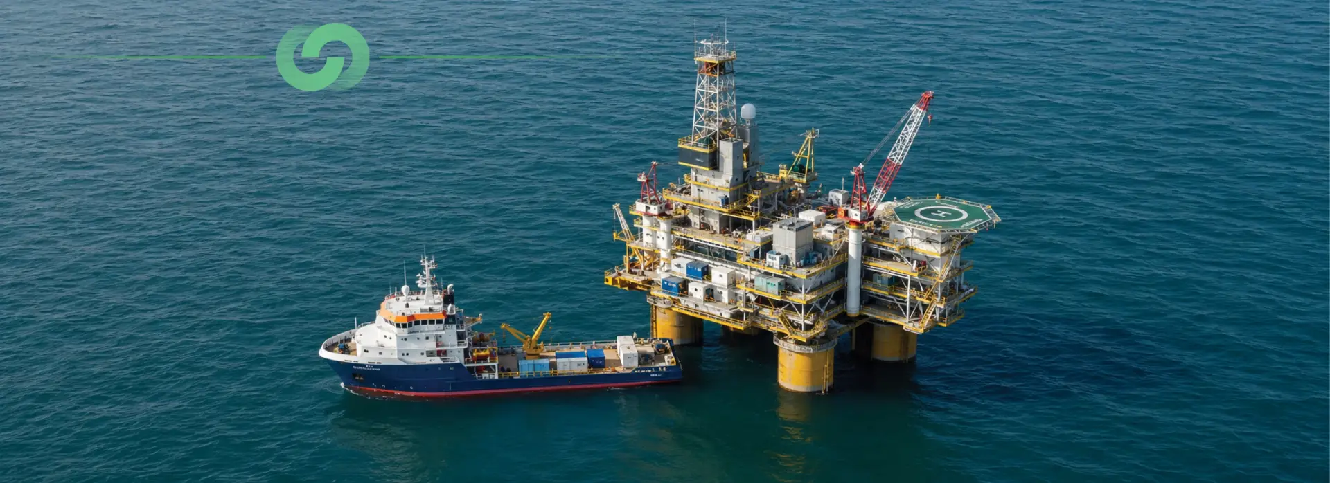
Upper Zakum hosts a network of ageing well-head platforms, satellite gathering facilities and a central complex. Over 30 years of exposure to the Arabian Gulf environment has caused severe corrosion and structural degradation of boat landing and barge bumper assemblies, placing mooring integrity, berthing safety and operational continuity at risk. The EPC contractor needed a precise, risk-free seabed baseline to support the safe replacement of 18 boat landings across 12 platform sites. This called for high-resolution bathymetry to accurately position the new structures, sub-bottom profiling to assess shallow geology and detect buried utilities, and magnetometer detection to identify ferrous debris and pipeline footprints. It also required side-scan sonar imaging to map seabed features and potential obstructions, tide and vertical control to reduce soundings to chart datum, and digital deliverables compatible with the client's CAD, GIS and SSDM workflows. All work had to be performed within a tight schedule, in a high-traffic offshore environment, while meeting stringent international hydrographic standards (IHO S-44, OGP SSDM, IMCA, ISO 9001/14001/45001).
2. Our Approach & Solution
- Pre-Survey — Control & Calibration: established a WGS-84 benchmark and permanent GPS stations; performed RTK DGPS calibration, multibeam patch test, side-scan USBL check and sub-bottom profiler alignment; integrated a 3 m tide gauge with auto-log to hold vertical accuracy within ±0.05 m.
- Survey Execution — Bathymetry: MBES (Seabat 8101) at 200–400 kHz provided a 0.5 m × 0.5 m gridded surface at ≤1 m horizontal and ≤0.25 m vertical uncertainty, cross-checked by single-beam (Echotrac E20) to within ±0.2 m, with line spacing adapted to depth (10 m near the jacket, 25 m, then 50 m) and 133% side-scan overlap.
- Survey Execution — Geophysics: EdgeTech 4125 dual-frequency (300/600 kHz) side-scan achieved >100% coverage at 0.5 m resolution; GeoAcoustics sub-bottom profiler (1.5–18 kHz) penetrated up to 50 m at 0.1 m resolution; a Geometrics G-882 magnetometer resolved anomalies at 0.01 nT/m to detect pipelines, buried cables and ferrous debris.
- Tidal & Vertical Control: real-time tide corrections from ATG data and RTK height reduced all soundings to LAT / chart datum.
- Post-Processing & Delivery: data were processed onboard (HYPACK MAX) and in-office (CARIS, ArcGIS), verified for overlap and line continuity, and merged into a 0.5 m Digital Terrain Model; SSDM-compliant GIS databases, AutoCAD 2022 drawings, A1 charts and a Final Technical & Operations Report were issued via a secure portal under full ISO 9001/14001/45001 QA/QC.
3. Technologies & Methodologies
4. Results & Impact:
- Survey Area: Covered 12 platform sites — combining small (400 m × 400 m) and large (3,000 m × 3,000 m) blocks — delivering a complete seabed baseline for 18 boat landings.
- Coverage: Achieved 100% MBES swath coverage with 20% overlap and >100% side-scan overlap, ensuring no data gaps and full risk-free positioning.
- Resolution: Produced a 0.5 m × 0.5 m DTM and 0.1 m sub-bottom resolution, enabling precise leg-penetration analysis.
- Accuracy: Delivered horizontal accuracy ≤1 m and vertical accuracy ≤0.25 m, meeting IHO M-3 and OPCO standards.
- Feature Detection: Identified 2 pipelines, 10-inch water lines, 5 buried cable routes, and 3 debris hotspots, supporting immediate remediation planning.
- Timeline: Completed in 2 weeks mobilisation, 3 weeks survey, and 3.5 weeks processing — finishing 20% ahead of the EPC schedule.
- HSE: Recorded zero incidents with full ISO 45001 compliance, maintaining the offshore safety record.
- Digital Deliverables: Provided A1 charts, an SSDM GIS database, and AutoCAD 2022 files for seamless integration into construction and asset systems.
- Cost Efficiency: Reduced re-survey risk by 30% versus conventional methods, yielding estimated savings of USD 1.2 M across the project.
5. Conclusion
By delivering an exhaustive, multi-platform seabed survey that combined high-resolution bathymetry, advanced sub-bottom profiling, magnetometer mapping and precise tidal control, we enabled the client to replace boat landings with confidence, reduce construction risk and accelerate project delivery. The outcome exemplifies our commitment to Digital Twin Solutions, Geospatial Technology and Precision Surveying Services that underpin modern offshore engineering projects — turning a corroded, high-risk asset into a fully characterised, build-ready environment.
Trusted by Industry Leaders
We partner with offshore operators and pipeline companies to deliver precision survey solutions.

Offshore Operations
Major offshore oil and gas operators trust our survey technology for critical infrastructure projects.

Pipeline Companies
Leading pipeline infrastructure companies rely on our precision mapping and underground utility services.

Engineering Firms
Engineering consultancies partner with us for accurate survey data and 3D modeling services.
IMPACT

Timeline
Comprehensive survey results delivered in six weeks.

Deliverables
Topographical drawings, digital terrain models, contour maps, longitudinal profiles, 2D & 3D underground utility maps.

Safety
Avoided potential hazards and optimized pipeline route.

Cost-Efficiency
Achieved significant cost savings and reduced construction time.

Technology
Utilized advanced tools like LiDAR and GPR.

Efficiency
Enhanced data collection and analysis processes.