Geotechnical Investigations

Geospatial services

Our geotechnical investigation services deliver critical borehole data collection and geophysical surveys to assess soil stability and subsurface conditions. We provide the definitive foundation design data needed for safe, cost-effective construction.

Ground Truth Intelligence in Days, Not Assumptions

Our geotechnical investigation services are built on decades of ground engineering expertise, deploying an integrated methodology that spans rotary and percussion drilling, Cone Penetration Testing (CPT/CPTu), Standard Penetration Testing (SPT), in-situ testing, geophysical surveys, and accredited laboratory analysis to precisely characterize soil, rock, and groundwater conditions across any site, terrain, or geology.

What sets us apart is not just the data we acquire — it is the intelligence we extract from it. Our geotechnical engineers deliver fully classified subsurface datasets with clear, actionable recommendations that directly support your foundation design, earthworks strategy, and ground improvement decisions. Every report we produce is engineered to protect your design assumptions, de-risk your construction methodology, and defend your project economics against the uncertainties that derail projects and inflate costs.

We mobilize fast, work with precision, and deliver interpreted geotechnical reports in days — because the ground truth your project depends on should never be the reason progress waits.

How We Investigate the Ground: Integrated Site Characterization

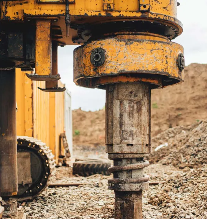
Geotechnical Drilling

Our approach combines rotary core drilling and percussion/auger drilling to obtain high-quality data essential for design and analysis.
Through diamond-bit rotary core drilling, we recover continuous core samples from soil and rock formations,
allowing for precise lithological logging, discontinuity mapping, and detailed laboratory testing.
In softer overburden soils, we utilize cable percussion (shell and auger) and hollow-stem auger
drilling methods for rapid borehole advancement.

In-Situ Testing Techniques

We conduct comprehensive in-situ testing to evaluate soil behavior and engineering properties
directly within the ground. Our methods include Cone Penetration Testing (CPT/CPTu) and Standard
Penetration Testing (SPT), both providing valuable data for geotechnical design and analysis.
All CPT and SPT results are energy-corrected (N₆₀) and normalized for overburden pressure ((N₁)₆₀) in accordance with
ASTM D1586 and BS EN ISO 22476-3 standards.

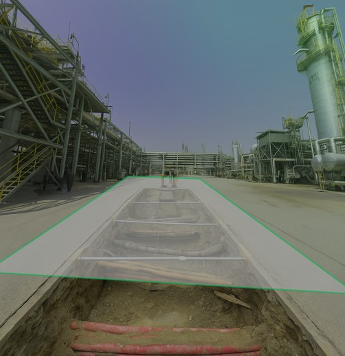
Geophysical Ground Profiling

Non-invasive subsurface imaging using seismic refraction/MASW, electrical resistivity tomography (ERT),
and ground penetrating radar (GPR) — providing continuous 2D and 3D ground profiles between boreholes.
Geophysics bridges the gap between discrete borehole data points, identifying lateral variability,
buried structures, voids, and groundwater interfaces across the full site footprint.

Accredited Laboratory Testing: Data You Can Design On

Every soil and rock sample undergoes systematic laboratory testing in our accredited facilities — delivering
the engineering parameters your designers need with full traceability,
repeatability, and compliance with international standards.
All laboratory testing complies with BS 1377, ASTM D-series, BS EN ISO 17892,
and AASHTO standards.

What We Deliver: Actionable Ground Intelligence

Factual Geotechnical Reports

Comprehensive documentation of all field investigation activities — borehole logs, CPT profiles, in-situ test results,
and laboratory test certificates presented in accordance with BS 5930, BS EN ISO 14688/14689, and AGS digital data format.
Factual reports provide the auditable, uninterpreted record of ground conditions encountered.

3D Ground Models

Three-dimensional geological and geotechnical models integrating borehole data, CPT profiles,
geophysical surveys, and topographic information into interactive digital ground representations.
3D ground models enable visualization of stratigraphic variability, identification of geotechnical risk zones,
and direct integration with BIM environments for clash detection and construction planning.

Geotechnical Design Parameters

Characteristic and design values for bearing capacity, shear strength, deformation modulus,
consolidation parameters, and hydraulic conductivity — derived from statistical analysis of field and laboratory
data in accordance with Eurocode 7 (BS EN 1997) partial factor methodology.
Parameters are presented with clear justification, sensitivity analysis, and uncertainty assessment.

Digital Data Deliverables

All investigation data delivered in AGS digital format alongside traditional PDF reports — enabling
direct import into geotechnical analysis software (Plaxis, GeoStudio, Rocscience), BIM platforms,
and GIS environments. Digital-first delivery eliminates manual data entry,
reduces transcription errors, and accelerates your engineering workflows.

Industries We Serve

industry image

deliver image

Oil & Gas

Pipeline Route Survey | Facility Change Detection | Methane Emission Monitoring | | Offshore Platform
Surveillance | Oil Spill Detection | SCADA-GIS Integration I AL/ML based Asset Moniroting

industry  image

industry image

AEC & Building Documentation

Scan-to-BIM Conversion | Construction Progress Monitoring | As-Built Verification | Renovation Design Support |
MEP Coordination

industry  image

deliver image

Infrastructure & Transportation

Traffic flow simulation I Urban Planning | Citizen Service Mapping | Emergency Management | Public Health
Mapping I Rail Network Monitoring | InSAR Settlement Monitoring I Digital twin Development

industry image

deliver image

Mining & Quarrying

Mineral Mapping | Open Pit Volume Monitoring | Tailings Dam Surveillance | Mining Subsidence Monitoring |
Progressive Rehabilitation Tracking | Environmental Compliance Reporting I HSE Virtual Tour

industry  image

industry image

Manufacturing & Industrial

Plant Documentation | Equipment Routing | Maintenance Planning | Digital Twins | Risk Management | VR HSE
Training

industry  image

deliver image

Utilities & Networks

Underground Mapping | Route Planning & Conflict Detection | Asset Documentation | Damage Assessment | Safety
Verification

industry image

deliver image

Coastal, Marine & Hydrographic

Shoreline Change Detection | Satellite Bathymetry | Coastal Erosion Monitoring | Marine Habitat Mapping | Flood
Inundation Modelling | Sediment Transport Analysis

industry  image

industry image

Environmental Management

Environmental Impact Assessment | Habitat Classification | Carbon Accounting | Water Quality Monitoring | Land
Degradation Assessment | Climate Change Indicators | Sustainability Reporting

industry  image

deliver image

Defense, Security & Intelligence

Force Deployment Planning | Terrain Analysis | Border Surveillance Analytics | Geospatial Intelligence (GEOINT)
And Image Intelligence (IMINT)

Our Methodology: Precision at Every Stage

A proven four-stage process ensuring accuracy, compliance, and actionable insights

deliver image

Plan with Intelligence

Before mobilizing, we begin with a data-driven understanding of your asset environment. We perform a comprehensive site intelligence review — analyzing existing drawings, access limitations, hazardous zones, operational constraints, and required accuracy levels.

deliver image

Precision Field Acquisition with real time QC

Our field teams deploy fully calibrated instruments in strict accordance with manufacturer specifications and project QA protocols. Intelligent workflows deliver real-time on-site feedback on coverage, registration integrity, and data quality

deliver image

AI-Driven Data Processing & Extraction

Curates raw data, Guides AI, Validates Output into actionable digital intelligence through a hybrid pipeline of advanced algorithms, machine learning models, and expert review.

deliver image

Decision-Ready Deliverables

Outputs are not merely models but enterprise-ready information assets. All datasets undergo independent quality assurance audits. We ensure your organization can immediately operationalize the data for planning, maintenance, and strategic decision-making.

Case Studies

We're building a greener tomorrow. Our solutions optimize operations, cut waste, and lower emissions, supporting net-zero goals.

Geospatial services

Precision Geodetic Monitoring

Millimeter-accurate subsidence monitoring across 35 offshore platforms using advanced GNSS technology and international reference frames. Our exacting survey approach achieved sub-centimeter precision over 100km baselines…

±3mm
Positioning Accuracy
35
Platforms Monitored
100km
Baseline Precision
Geospatial services

Geospatial Mapping

Revolutionizing large-scale topographic mapping with advanced mobile LiDAR technology. Our rapid deployment solution captured 19 million square meters of complex terrain in record time, delivering…

4 Weeks
Project Completion
80%
Data Accuracy
100%
Data Accuracy
Geospatial services

Utility Mapping & Detection

Eliminating subsurface uncertainty with advanced ground penetration radar and electromagnetic detection technologies. Our comprehensive 3D utility mapping provides complete visibility of underground infrastructure

Zero
Utility Strikes
95%
Detection Accuracy
100%
Project Compliance

Why Organizations Choose Our Geotechnical Investigation Services

Technical Excellence

Industry-leading accuracy specifications (±1–2 mm TLS, ±2–5 cm aerial) backed by systematic, documented QA/QC processes ensuring reliable, repeatable results across diverse project types — from offshore platforms in extreme marine environments to sensitive heritage interiors.

Operational Efficiency

Multi-platform deployment and AI-accelerated processing compress project timelines by up to 70%. What once required months of manual survey and CAD drafting now delivers registered, classified point clouds and intelligent models in days to weeks.

Integrated Solutions

Complete service delivery from project planning and field acquisition through processing, modeling, and specialized analysis — all under one roof. No fragmented vendor chains, no data conversion losses, no accountability gaps.

Industry Expertise

25+ years of specialized knowledge across regulated, high-stakes environments. We don’t just capture geometry — we understand what it means for your operations, your compliance obligations, and your capital planning decisions.

Proven ROI

Our clients consistently document measurable returns: 30–50% reduction in field rework, 20–40% faster project delivery, elimination of fabrication mismatches, and extended asset service life through predictive condition monitoring. Reality capture isn’t an expense — it’s a multiplier on every downstream decision.

The Spatial Intelligence Advantage

The geospatial industry is undergoing a fundamental transformation. AI-powered point cloud classification, real-time SLAM navigation, and cloud-based digital twin platforms are converging to make reality capture faster, more accessible, and more valuable than ever before.

Contact Our Specialist

Get in touch to discuss comprehensive terrestrial and aerial laser scanning addressing your project requirements.


Global Operations
24/7 support across multiple time zones