Satellite Photogrammetry & Remote Sensing

Geospatial services

We leverage advanced remote sensing with multispectral and SAR satellite data to deliver comprehensive earth observation solutions. Our satellite imagery analysis enables change detection, deformation monitoring, and predictive terrain analytics for informed decision-making.

High-Definition Earth Intelligence From Space — Precision Geospatial Insights

We deliver professional satellite photogrammetry and remote sensing services that convert multi-sensor satellite imagery into survey-grade geospatial intelligence. Our integrated earth observation capabilities — very-high-resolution (VHR) optical imaging, multispectral analysis, hyperspectral mapping, Synthetic Aperture Radar (SAR), InSAR deformation monitoring, and thermal infrared sensing — enable organizations to monitor, measure, and manage the Earth’s surface with a precision, coverage, and revisit frequency that ground-based survey and aerial mapping methods cannot match.

Our satellite remote sensing and photogrammetric processing services harness the revolution, delivering orthorectified imagery, high-accuracy digital elevation models (DEMs), land use/land cover classification, multi-temporal change detection, InSAR subsidence maps, and spectral analytics across project areas spanning hectares to entire nations.

From a single acquisition to a continuous earth observation programme, we provide the satellite-derived intelligence your organisation needs — precisely when and where decisions require it most.

How We Capture Earth Intelligence

Multi-Sensor Satellite Earth Intelligence

Multi-sensor satellite technology is used to capture high-fidelity Earth intelligence by matching
the right sensor to the right application, from engineering design to environmental monitoring.
Integrated workflows fuse very-high-resolution optical, multispectral, and hyperspectral satellite
data into a single geospatial environment, maximizing information extraction, classification accuracy,
and decision-ready insight for infrastructure, energy, environmental, and government clients.

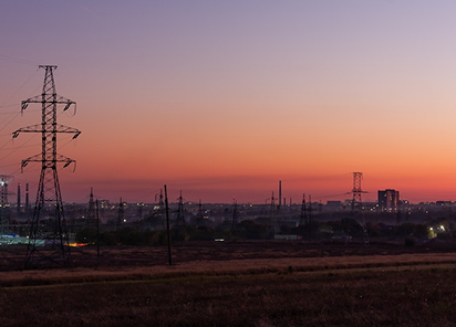
Very-High-Resolution Optical Satellite Imagery

Very-high-resolution (VHR) optical satellite imagery delivers panchromatic and pansharpened products at approximately 25–30 cm ground sample distance (GSD), enabling feature-level mapping of buildings, roads, assets, and critical infrastructure. Modern constellations provide us 6–8 multispectral bands (from deep blue through near‑infrared), supporting robust feature extraction, land‑cover classification, vegetation and change indices, and wide-area topographic mapping.

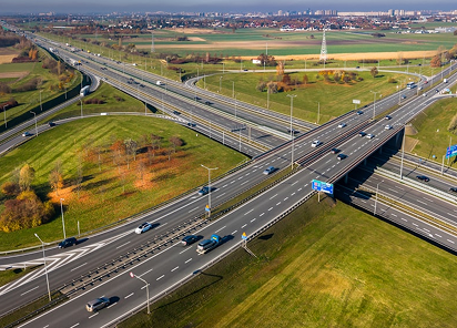
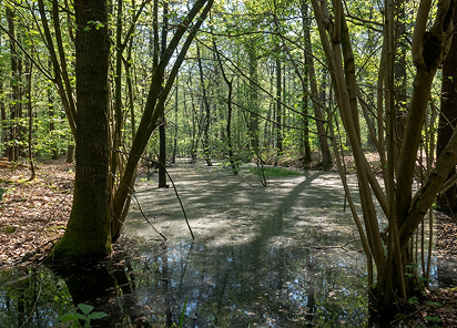
Multispectral Satellite Imagery for Monitoring Change

Medium-resolution multispectral satellite platforms such as Sentinel-2, Landsat-9, and PlanetScope
provide systematic global coverage with revisit intervals typically ranging from daily to every 16 days.
These sensors are ideal for time-series analysis of vegetation health, land use and land cover change,
water quality, coastal dynamics, and environmental compliance reporting over large areas at optimized cost.

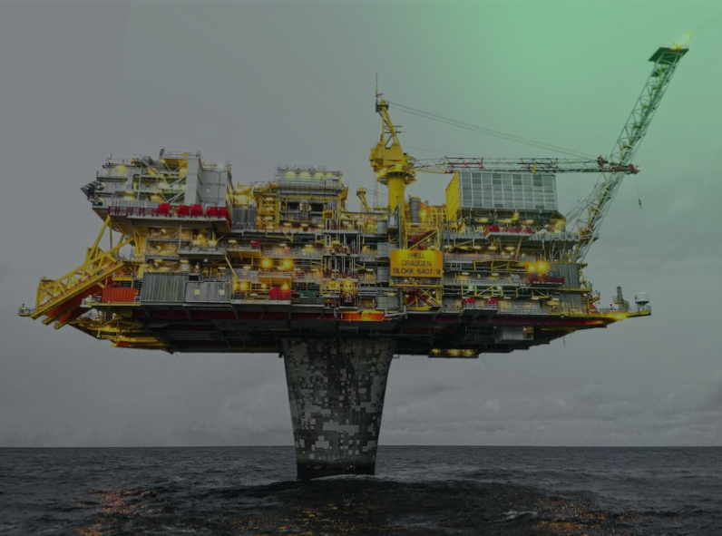
Hyperspectral Satellite Imaging for Material Intelligence

Hyperspectral satellite sensors capture data across more than 200 contiguous, narrow spectral bands,
typically with bandwidths in the 5–10 nm range, enabling material-level discrimination well beyond
traditional broadband multispectral imagery. By integrating hyperspectral outputs into advanced geospatial analytics,
we gain actionable “material intelligence” to reduce exploration risk, target interventions,
and meet stringent environmental and ESG reporting requirements.

What We Deliver: Satellite Remote Sensing Deliverables & Data
Products

Orthorectified Satellite Imagery Products

Geometrically corrected, radiometrically calibrated imagery delivered as pansharpened true-color composites,
multispectral layer stacks, and individual band products. All orthoimagery is projected to client-specified
coordinate reference systems with documented CE90 positional accuracy — ready for direct GIS, CAD, and BIM
integration.

Digital Elevation Models (DEM) & Digital Surface Models (DSM)

Satellite stereo-derived elevation products in GeoTIFF, ASCII grid, LAS, and contour vector formats.
Product suite includes bare-earth DEMs, full-surface DSMs, slope/aspect/curvature maps, hillshade
visualizations,
and hydrological flow models supporting engineering design, flood modelling, and volumetric analysis.

Thematic Classification Maps & GIS Databases

Machine learning-classified land cover, land use, vegetation health, and environmental condition maps in
GIS-ready vector (Shapefile, GeoPackage, GeoJSON) and raster (GeoTIFF) formats. All classifications include
accuracy assessment documentation with confusion matrices, kappa coefficients, and per-class accuracy
statistics.

Change Detection Analysis Reports

Multi-temporal landscape change analysis — urban expansion, vegetation loss, coastal retreat, construction
progress, unauthorized development — with quantified areas, rates of change, and geospatial distribution.

InSAR Ground Deformation Maps & Time-Series

PS-InSAR and SBAS displacement velocity maps, cumulative displacement profiles, and point-wise time-series
documenting ground surface movement at millimeter precision. Products include spatial deformation maps, risk
classification overlays, and interpreted geotechnical assessments for infrastructure and natural terrain.

GIS-Ready Databases, Web Map Services & Interactive Viewers

All deliverables packaged in OGC-compliant interoperable formats (GeoTIFF, Shapefile, GeoPackage, GeoJSON,
KML/KMZ) with ISO 19115 metadata. Enterprise deployments include WMS/WMTS web services and interactive
browser-based map viewers enabling organization-wide access to satellite intelligence products.

Industries We Serve

industry image

deliver image

Oil & Gas

Pipeline Route Survey | Facility Change Detection | Methane Emission Monitoring | | Offshore Platform
Surveillance | Oil Spill Detection | SCADA-GIS Integration I AL/ML based Asset Moniroting

industry  image

industry image

AEC & Building Documentation

Scan-to-BIM Conversion | Construction Progress Monitoring | As-Built Verification | Renovation Design Support |
MEP Coordination

industry  image

deliver image

Infrastructure & Transportation

Traffic flow simulation I Urban Planning | Citizen Service Mapping | Emergency Management | Public Health
Mapping I Rail Network Monitoring | InSAR Settlement Monitoring I Digital twin Development

industry image

deliver image

Mining & Quarrying

Mineral Mapping | Open Pit Volume Monitoring | Tailings Dam Surveillance | Mining Subsidence Monitoring |
Progressive Rehabilitation Tracking | Environmental Compliance Reporting I HSE Virtual Tour

industry  image

industry image

Manufacturing & Industrial

Plant Documentation | Equipment Routing | Maintenance Planning | Digital Twins | Risk Management | VR HSE
Training

industry  image

deliver image

Utilities & Networks

Underground Mapping | Route Planning & Conflict Detection | Asset Documentation | Damage Assessment | Safety
Verification

industry image

deliver image

Coastal, Marine & Hydrographic

Shoreline Change Detection | Satellite Bathymetry | Coastal Erosion Monitoring | Marine Habitat Mapping | Flood
Inundation Modelling | Sediment Transport Analysis

industry  image

industry image

Environmental Management

Environmental Impact Assessment | Habitat Classification | Carbon Accounting | Water Quality Monitoring | Land
Degradation Assessment | Climate Change Indicators | Sustainability Reporting

industry  image

deliver image

Defense, Security & Intelligence

Force Deployment Planning | Terrain Analysis | Border Surveillance Analytics | Geospatial Intelligence (GEOINT)
And Image Intelligence (IMINT)

Our Methodology: Precision at Every Stage

A proven four-stage process ensuring accuracy, compliance, and actionable insights

deliver image

Plan with Intelligence

Before mobilizing, we begin with a data-driven understanding of your asset environment. We perform a comprehensive site intelligence review — analyzing existing drawings, access limitations, hazardous zones, operational constraints, and required accuracy levels.

deliver image

Precision Field Acquisition with real time QC

Our field teams deploy fully calibrated instruments in strict accordance with manufacturer specifications and project QA protocols. Intelligent workflows deliver real-time on-site feedback on coverage, registration integrity, and data quality

deliver image

AI-Driven Data Processing & Extraction

Curates raw data, Guides AI, Validates Output into actionable digital intelligence through a hybrid pipeline of advanced algorithms, machine learning models, and expert review.

deliver image

Decision-Ready Deliverables

Outputs are not merely models but enterprise-ready information assets. All datasets undergo independent quality assurance audits. We ensure your organization can immediately operationalize the data for planning, maintenance, and strategic decision-making.

Case Studies

We're building a greener tomorrow. Our solutions optimize operations, cut waste, and lower emissions, supporting net-zero goals.

Geospatial services

Precision Geodetic Monitoring

Millimeter-accurate subsidence monitoring across 35 offshore platforms using advanced GNSS technology and international reference frames. Our exacting survey approach achieved sub-centimeter precision over 100km baselines…

±3mm
Positioning Accuracy
35
Platforms Monitored
100km
Baseline Precision
Geospatial services

Geospatial Mapping

Revolutionizing large-scale topographic mapping with advanced mobile LiDAR technology. Our rapid deployment solution captured 19 million square meters of complex terrain in record time, delivering…

4 Weeks
Project Completion
80%
Data Accuracy
100%
Data Accuracy
Geospatial services

Utility Mapping & Detection

Eliminating subsurface uncertainty with advanced ground penetration radar and electromagnetic detection technologies. Our comprehensive 3D utility mapping provides complete visibility of underground infrastructure

Zero
Utility Strikes
95%
Detection Accuracy
100%
Project Compliance

Why Organizations Choose Our Satellite Remote Sensing Services

Technical Excellence

Industry-leading accuracy specifications (±1–2 mm TLS, ±2–5 cm aerial) backed by systematic, documented QA/QC processes ensuring reliable, repeatable results across diverse project types — from offshore platforms in extreme marine environments to sensitive heritage interiors.

Operational Efficiency

Multi-platform deployment and AI-accelerated processing compress project timelines by up to 70%. What once required months of manual survey and CAD drafting now delivers registered, classified point clouds and intelligent models in days to weeks.

Integrated Solutions

Complete service delivery from project planning and field acquisition through processing, modeling, and specialized analysis — all under one roof. No fragmented vendor chains, no data conversion losses, no accountability gaps.

Industry Expertise

25+ years of specialized knowledge across regulated, high-stakes environments. We don’t just capture geometry — we understand what it means for your operations, your compliance obligations, and your capital planning decisions.

Proven ROI

Our clients consistently document measurable returns: 30–50% reduction in field rework, 20–40% faster project delivery, elimination of fabrication mismatches, and extended asset service life through predictive condition monitoring. Reality capture isn’t an expense — it’s a multiplier on every downstream decision.

The Spatial Intelligence Advantage

The geospatial industry is undergoing a fundamental transformation. AI-powered point cloud classification, real-time SLAM navigation, and cloud-based digital twin platforms are converging to make reality capture faster, more accessible, and more valuable than ever before.

Contact Our Specialist

Get in touch to discuss comprehensive terrestrial and aerial laser scanning addressing your project requirements.


Global Operations
24/7 support across multiple time zones