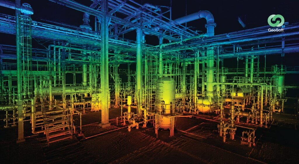
Why a single high-fidelity capture of an asset pays back for years, and how 3D laser scanning, and digital twins turn a one-off survey into a decade of decisions.
Introduction
Most survey work is quietly mispriced. Not in dollars, but in time horizon. Reality capture is often bought as a one-off: scan the asset, deliver the data, close the job. Budgeted that way, it looks like a cost. Understood properly, it is something closer to an appreciating asset, a single accurate capture of a facility that keeps informing decisions for a decade or more.
That reframe matters, because the biggest returns from reality capture rarely show up on the day the data is delivered. They show up two years later when a modification is planned, five years later during an inspection, and eight years later when the asset is modified again. Each time, the answer comes without sending a crew back into a live, hazardous, or hard-to-access environment. This article makes the case for that longer view, and explains where the lifetime value actually comes from.
What is reality capture?
Reality capture is the process of digitally recording a physical asset or environment exactly as it exists, using technologies such as 3D laser scanning, LiDAR, and photogrammetry. The output is a dense, dimensionally accurate 3D record, a point cloud, that represents the real as-built condition of the asset rather than an idealised drawing.
That distinction is the whole point. Reality capture records what is actually there. And what is actually there has a way of being far more valuable, for far longer, than anyone budgets for at capture time.
The one-off myth: why reality capture is mispriced
The instinct to treat a scan as a single-use deliverable comes from how it is procured, tied to one project, one need, one budget line. But the data does not expire when the project closes. A point cloud captured today is still an accurate record of the asset next year, and the year after.
The mispricing happens because the cost is concentrated on day one, while the value is distributed across the asset’s life. Judge it only against the immediate task and it looks expensive. Judge it against every future decision it will inform, and the economics invert.
Where the lifetime value comes from
The return on a single capture accumulates across the asset lifecycle:
1. Avoiding repeat mobilisations. This is the most obvious saving. Every time a question about the asset arises, whether dimensions, clearances, or clash checks, it can be answered from the existing data instead of sending a crew back. On offshore or live industrial sites, each avoided remobilisation saves significant cost, time, and risk.
2. Faster, safer future modifications. When the asset is modified, and it will be, designers work from the accurate as-built capture rather than guessing from outdated drawings. Clashes surface on screen, not on site. This is where Scan-to-BIM and downstream engineering compound the original capture’s value.
3. A foundation for a digital twin. A capture is the raw material for a digital twin, a living, data-rich representation used across the asset’s operational life for planning, monitoring, and decision-making. One capture seeds a tool that pays back continuously.
4. Remote access to a physical asset. Teams can measure, inspect, and plan from the data instead of travelling to, or entering, the asset. For dispersed operations across the GCC, Asia, and offshore, that turns a physical asset into one that can be interrogated from anywhere.
5. A defensible record. An accurate, time-stamped capture is a factual record of the asset’s condition at a moment in time. That is valuable for disputes, compliance, insurance, and change management.
6. Deferred and cheaper future surveys. Because much of the asset does not change, future work often only needs to capture the delta, updating the existing model rather than starting from zero.
Consider the alternative to capturing once, which is capturing repeatedly, on demand, every time a decision needs data. Each of those return trips carries mobilisation cost, scheduling delay, safety exposure, and, on operating assets, potential production disruption.
A single high-fidelity capture front-loads that cost once and amortises it across every future use. The more times the asset is questioned, modified, or inspected over its life, the lower the effective cost per decision. Complex energy and infrastructure assets get questioned often, so that declining cost per decision is the real return, and it is invisible if you only look at the first invoice.
Getting it right: capture once, but capture well
The “scan once” logic only holds if the capture is good enough to rely on for a decade. That places the emphasis on quality at the moment of capture:
• Sufficient accuracy and density. Captured to a tolerance that will still serve future engineering needs, not just today’s.
• Complete coverage. Gaps discovered years later cannot be filled without remobilising, which defeats the purpose.
• Validated registration. The data must be dimensionally trustworthy and its accuracy documented.
• Well-structured, accessible data. Stored and formatted so it is usable years later by people who were not there at capture.
A weak capture is not a decade-long asset. It is a decade-long liability. This is why reality capture belongs with a survey engineering partner who captures for the asset’s life, not just the immediate job.
Conclusion
The most valuable thing about reality capture is not the scan. It is everything the scan makes possible afterwards. Judged as a one-off, it is a cost. Judged as what it truly is, a single accurate reusable record of an asset that informs decisions for a decade, it is one of the highest-return investments in an asset’s whole lifecycle.
Scan once. Decide for a decade.
At Geosoft Global, we capture assets to serve their entire life, with high-density 3D laser scanning and reality capture, validated for accuracy and built to feed digital twins and every future decision that follows.
Planning a capture, or want to get more from data you already have? Talk to our team.
Frequently Asked Questions
What is reality capture?
Reality capture is the process of digitally recording a physical asset or environment exactly as it exists, using 3D laser scanning, LiDAR, and photogrammetry to produce an accurate 3D record (a point cloud) of the as-built condition.
Is reality capture a one-time cost or a long-term asset?
While it is captured once, the data is a long-term asset. A single accurate capture can be reused for years, for modifications, inspections, digital twins, and decision-making, so its value accumulates across the asset’s lifecycle rather than ending at delivery.
How long is reality capture data useful?
As long as the asset has not materially changed, the data remains an accurate record, often useful for a decade or more. When parts of the asset change, only the changed areas typically need recapturing, updating the existing model rather than replacing it.
How does reality capture support a digital twin?
Reality capture provides the accurate as-built foundation a digital twin is built on. The point cloud is converted into an intelligent model and enriched with data, creating a living representation used across the asset’s operational life.
What makes a reality capture worth relying on for years?
Sufficient accuracy and density, complete coverage, validated registration, and well-structured accessible data. A capture done to the right standard becomes a long-term asset. An incomplete or inaccurate one loses its value quickly.