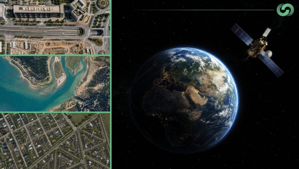
Why Satellite Imagery and AI Matter Now
Satellite imagery has evolved from static pictures of the Earth into a dynamic data stream that helps organizations monitor assets, detect risk, and plan smarter interventions. Modern deep learning models can automatically extract patterns and changes from huge volumes of multi-temporal satellite data, far beyond what traditional manual interpretation can handle. For infrastructure owners, utilities, and energy companies, this combination is becoming a strategic capability rather than a niche geospatial tool.
From Remote Sensing to Real-Time Insight
Traditional remote sensing workflows relied heavily on manual digitization, rule-based classification, and periodic surveys. These methods are accurate but slow, labour-intensive, and difficult to scale when assets span thousands of kilometres. AI-driven pipelines, by contrast, can ingest satellite imagery at regular intervals, automatically highlight where meaningful changes have occurred, and push alerts into enterprise systems with minimal human intervention.
Deep learning models such as convolutional neural networks (CNNs), U-Net, and its variants are now widely used to segment buildings, roads, vegetation, and water from satellite scenes with high precision. Hybrid architectures that mix encoder-decoder CNNs with temporal modules such as LSTMs, transformers, and attention mechanisms further boost performance when analyzing full time series instead of just image pairs.
AI Techniques Behind Modern Satellite Analytics
Change detection at scale
Change detection is the backbone of most satellite analytics for infrastructure and environmental monitoring. It focuses on identifying where and how the Earth’s surface has changed between two or more dates, such as new construction, land-use shifts, or vegetation growth. Modern approaches combine semantic segmentation with temporal modelling to generate pixel-level change maps that differentiate “no change,” “new built-up,” “vegetation loss,” and other classes.
Research shows that architectures like U-Net++ and Siamese networks can capture subtle structural changes between multi-temporal images, with accuracy scores above 0.84 to 0.86 in benchmark scenarios. Transformer-based models and multi-task learning frameworks further improve continuous urban change detection by preserving the temporal dimension and jointly optimizing segmentation and change outputs.
Semantic segmentation for asset intelligence
Semantic segmentation treats each pixel as a data point to be classified into meaningful categories such as road, building, vegetation, water, or bare soil. Models like U-Net and its variants have become the standard for this task, especially when high-resolution imagery is available. In urban infrastructure contexts, segmentation supports tasks such as extracting building footprints, tracing road networks, and mapping utility corridors with consistent accuracy.
Key Use Cases for Infrastructure and Energy Owners
1. Continuous urban and corridor monitoring
AI-powered change detection on satellite imagery is now used to monitor urban expansion, informal construction, and encroachment on critical corridors. Studies have demonstrated robust detection of new buildings and land-use transitions from multi-temporal Sentinel-2 and commercial high-resolution imagery over multi-year periods. By automating the generation of change maps, planners can focus on prioritizing interventions instead of manually scanning images.
Linear infrastructure such as roads, railways, and pipelines benefits from the same logic: capture imagery along corridors at regular intervals, run AI-based change detection, and flag anomalies like new structures, ground disturbance, or erosion zones. This drastically reduces the need for full-length field patrols while improving detection rates for genuine issues.
2. Vegetation encroachment and right-of-way safety
Vegetation management is one of the largest operational costs for utilities, and it is directly tied to safety and outage risk. In a pilot project using 50 cm Pléiades satellite imagery combined with AI algorithms, analysts were able to identify individual trees at risk of striking transmission lines in a 10 km² area, achieving close to 90% accuracy in field validation. The system flagged around 57,000 trees with potential strike risk, allowing crews to focus only on the most critical locations instead of patrolling the entire network.
Similarly, Southern Company used AI analysis on high-resolution satellite imagery to detect new construction within transmission rights-of-way, integrating alerts directly into its Esri ArcGIS environment. The AI workflow could identify early-stage land disturbances that often precede building activity, giving the utility more time to negotiate or enforce corridor protections.
3. Pipeline predictive maintenance
For oil and gas and water pipelines, AI-assisted satellite imagery is increasingly used to create predictive maintenance frameworks that replace purely schedule-based or reactive inspection regimes. Patent analyses show an ecosystem of solutions that feed sequences of geo-registered images at different times into deep neural networks to detect vegetation encroachment, ground subsidence, and structural deformation along corridors.
These models can forecast adverse conditions by learning how small changes in terrain or vegetation patterns correlate with eventual failures, leaks, or exposure incidents. Combined with on-the-ground sensors, this multi-source view allows operators to prioritize inspections where risk is objectively highest, instead of treating every kilometre as equal.
4. Asset condition monitoring and lifecycle optimization
Beyond discrete events, satellite imagery and AI support continuous asset condition monitoring across geo-distributed infrastructure portfolios. Platforms using satellite data, sensor feeds, and inspection records can track deterioration, rank assets by criticality and usage, and recommend optimal maintenance timings.
Vendors report that AI-driven geospatial analytics can reduce on-site inspections by around 50%, detect anomalies up to 40% faster than manual workflows, and cut maintenance-related failures by roughly 30% while reducing operational expenses by more than 30% through predictive strategies. For owners of bridges, roads, substations, and industrial facilities, this shifts maintenance from reactive firefighting to a more strategic, data-driven discipline.
5. Environmental and regulatory intelligence
Environmentally, deep learning applied to multi-temporal satellite imagery has shown clear gains in detecting deforestation, land-use change, and urban expansion, outperforming traditional change methods in both accuracy and computational efficiency. Using Landsat and Sentinel archives, models can identify land cover changes associated with human activity and natural hazards, helping organizations stay ahead of regulatory requirements and climate-related risks.
Where regulations require proof of compliance, such as maintaining buffer zones, preserving wetlands, or limiting construction in sensitive areas, AI-derived change maps and time-stamped imagery offer a defensible, auditable record.
Designing an Operational AI and Satellite Workflow
To turn satellite imagery and AI into a repeatable business capability, organizations typically move through a few practical steps.
1. Define priority questions and KPIs
The most successful programs start with clear business questions:
- Which assets or corridors are most critical to monitor?
- What constitutes a “change of interest” (for example, new buildings, vegetation height, or ground movement)?
- What KPIs matter, whether reduced truck rolls, fewer outages, faster anomaly detection, or regulatory compliance scores?
These definitions guide the choice of imagery (resolution, revisit rate, spectral bands) and the AI models to deploy, whether change detection, segmentation, or anomaly detection.
2. Choose the right imagery and revisit strategy
High-resolution commercial imagery (around 50 cm) is ideal where object-level detection is necessary, such as individual trees or small structures inside right-of-way corridors. For regional environmental monitoring and urban expansion studies, 10 m Sentinel-2 imagery and similar sources offer a good balance between coverage and detail.
Many operational systems task satellites on a schedule, capturing imagery every few months or even more frequently over high-risk areas, then feeding those acquisitions into automated AI pipelines.
3. Build robust training datasets
High-performing models depend on well-curated, labeled datasets covering the full range of conditions, seasons, and geographies of interest. Public benchmarks such as SpaceNet and Sentinel-based change datasets have helped accelerate research, but operational deployments usually require custom labeling on client-specific corridors and assets.
Data preprocessing, including normalization, cloud masking, co-registration, and tiling images into manageable patches, is critical to avoid spurious detections and to keep training efficient.
4. Integrate outputs into existing systems
The value of satellite AI is realized when insights appear inside the tools your teams already use, such as asset management systems, GIS platforms, maintenance planning tools, or custom dashboards. Successful case studies route AI-detected encroachments and vegetation risks directly into enterprise GIS and work-order systems, where they can be triaged and assigned.
Automated reporting, including maps, statistics, and historical trend lines, supports regulatory documentation and internal performance reviews without manual compilation.
Challenges and How Leading Teams Address Them
Despite the clear upside, satellite imagery and AI are not plug-and-play.
- Data quality and clouds: Optical satellites struggle with cloud cover and inconsistent lighting; combining multiple sensors and using temporal filtering can mitigate false positives.
- Model generalization: Models trained on one geography may not directly transfer to another due to different building styles, vegetation types, or terrain; fine-tuning with local data is often necessary.
- Hardware and scalability: Running complex models on high-resolution imagery at scale can be compute-intensive; research shows that some change detection models are still challenging to deploy on constrained satellite hardware, prompting exploration of lighter architectures.
Leading organizations address these issues through incremental rollouts, continuous model monitoring, and hybrid human and AI oversight, where analysts validate high-impact alerts before field action.
Where Geosoft Global Can Lead
For a company like Geosoft Global that already lives at the intersection of GIS, reality capture, and engineering, AI-powered satellite imagery is a natural extension of the digital asset lifecycle story. By combining satellite change detection for broad coverage, LiDAR and 3D scanning for high-fidelity detail on critical segments, and integrated dashboards tying both into project and maintenance KPIs, Geosoft can offer clients a multi-scale infrastructure intelligence platform, from orbital overview down to millimetre-accurate as-built conditions.
Positioning Geosoft as the integrator that turns raw Earth observation data into actionable asset decisions will resonate strongly with EPCs, utilities, and industrial operators looking to modernize their maintenance and risk strategies.
FAQs: Satellite Imagery, AI, and Infrastructure Management
1. What resolution do I need for infrastructure monitoring? For identifying individual trees, small structures, or fine-grained encroachments, commercial imagery around 50 cm resolution is typically required. For regional planning and broad land-use change, 10 m Sentinel-2 imagery or similar can be sufficient.
2. How often should I capture satellite imagery? It depends on asset criticality and risk tolerance. Many utilities and pipeline operators use quarterly or monthly acquisitions on high-priority corridors, with less frequent monitoring elsewhere. Continuous urban change research suggests that richer time series generally improves detection of gradual changes.
3. Can AI fully replace field inspections? No. AI is best viewed as a force multiplier. Case studies show that AI and satellite analytics can cut on-site inspections by about 50% and focus crews on the highest-risk locations, but field validation remains essential for complex or safety-critical interventions.
4. How accurate are AI-based change detection models? State-of-the-art models routinely achieve high overall accuracy, often above 90% in controlled benchmarks, and specialized architectures report F1 scores above 0.5 to 0.6 for difficult urban change tasks. Operational accuracy depends heavily on training data quality, sensor characteristics, and local conditions.
5. How does this integrate with our existing GIS and asset systems? Modern platforms push AI outputs, such as change polygons, risk scores, and alerts, directly into GIS environments such as ArcGIS and into asset management systems through APIs. This allows your teams to work in familiar tools while benefiting from continuous satellite-driven intelligence.